History of the Hunter Estuary

History of the Hunter Estuary
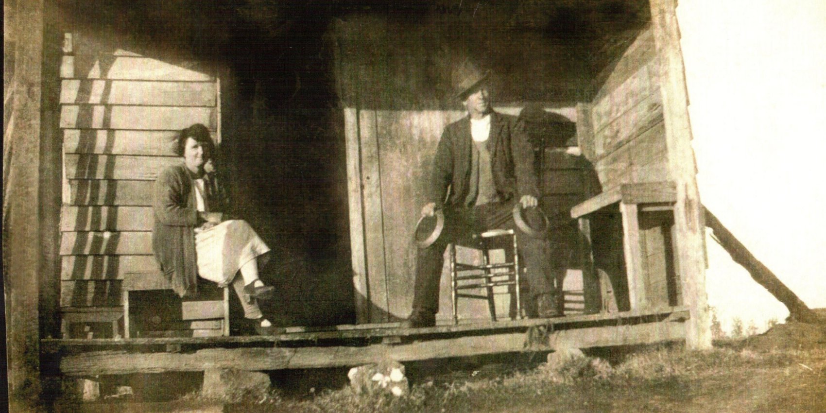
The history of the Hunter River estuary is the history of the Kooragang Wetlands. Scattered throughout this landscape are structures that hint of Ash Island’s more recent European past which includes dairy farming, surveillance capabilities during World War II and a community large enough to support a two teacher school. We have restored a number of these sites so we can use the structures to indirectly assist habitat restoration works.
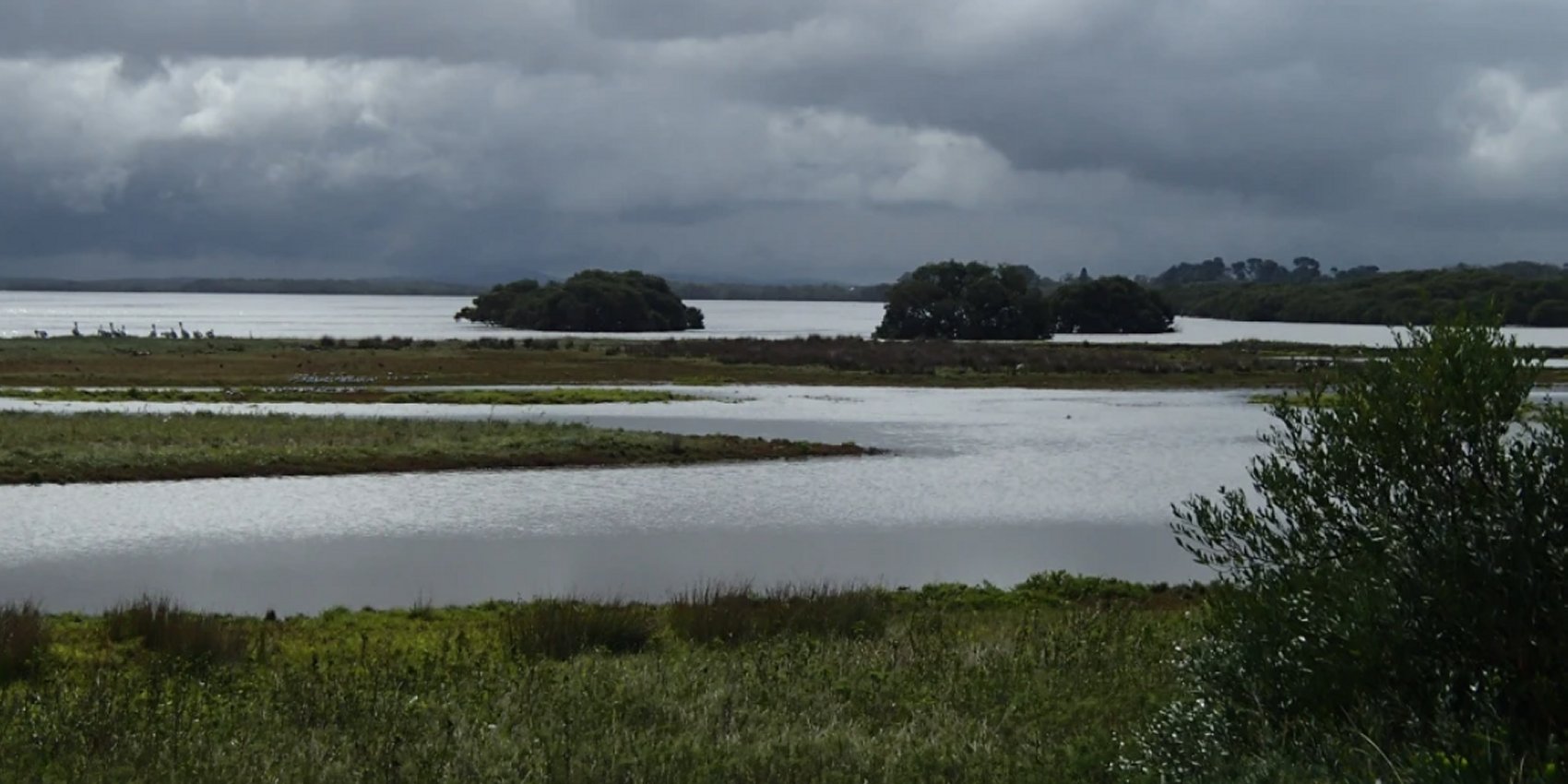
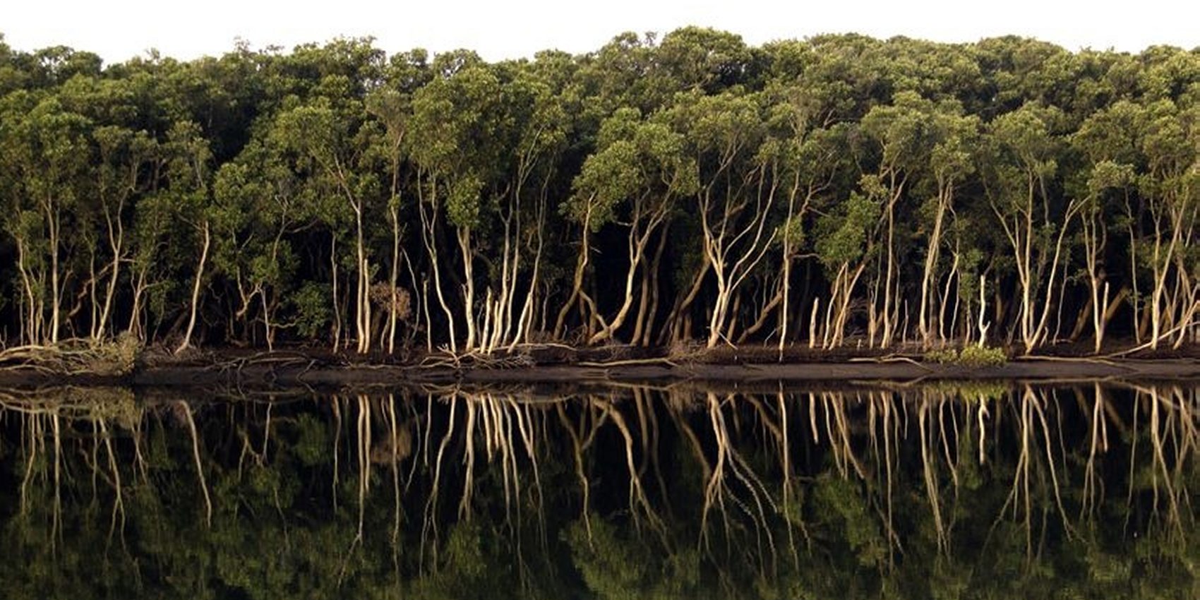
The Hunter River estuary is a biodiversity hotspot. It is a mosaic of habitats made up of mangroves and saltmarsh in the intertidal areas, and remnants of lowland floodplain rainforest, riparian woodlands, introduced pasture grasses, and small areas of ‘freshwater’ wetlands on some of the low-lying non-tidal areas. Historical records show that more than 300 plant species are indigenous to Ash Island.
Pre-European era:
For thousands of years Worimi and Awabakal people have hunted and gathered food on and around the 20 or so islands and mudflats of the Hunter River Estuary. They thrived on the abundant fish, shellfish, water birds and other animals as well as shoots and tubers of wetland plants. Floodplain rainforest flourished in non-tidal areas of the larger islands. A timeline of dates and occurrences shows that much has changed in the 200 or so years since Europeans discovered the Hunter River. The effects of these changes on the extent and health of fisheries and other wildlife habitat in the Hunter River estuary including historical maps and calculations of changes in various types of habitat can be found on NSW DPI Fisheries website. In the eastern part of the Hunter River estuary, lies Stockton Sandspit, today an important site for migratory wading birds but it wasn’t always so.
Timber-getting era:
Within 20 years of European arrival in 1797 valuable timber, such as red cedar and ash (after which the island was named), had been removed from the Hunter estuary. The islands were cleared of prized timber such as red cedar, rosewood and ash during the first 20 years of European settlement. Despite this early timber getting, most of the rainforest canopy remained for the next four decades, with only small areas cleared for market gardens and orchards. Major land clearing and draining occurred in the mid 1860s when the largest of the estuary islands, Ash Island was sub-divided into smaller farms. The non-native pasture grass, Kikuyu, was introduced at this time.
‘A remarkably fine place’:
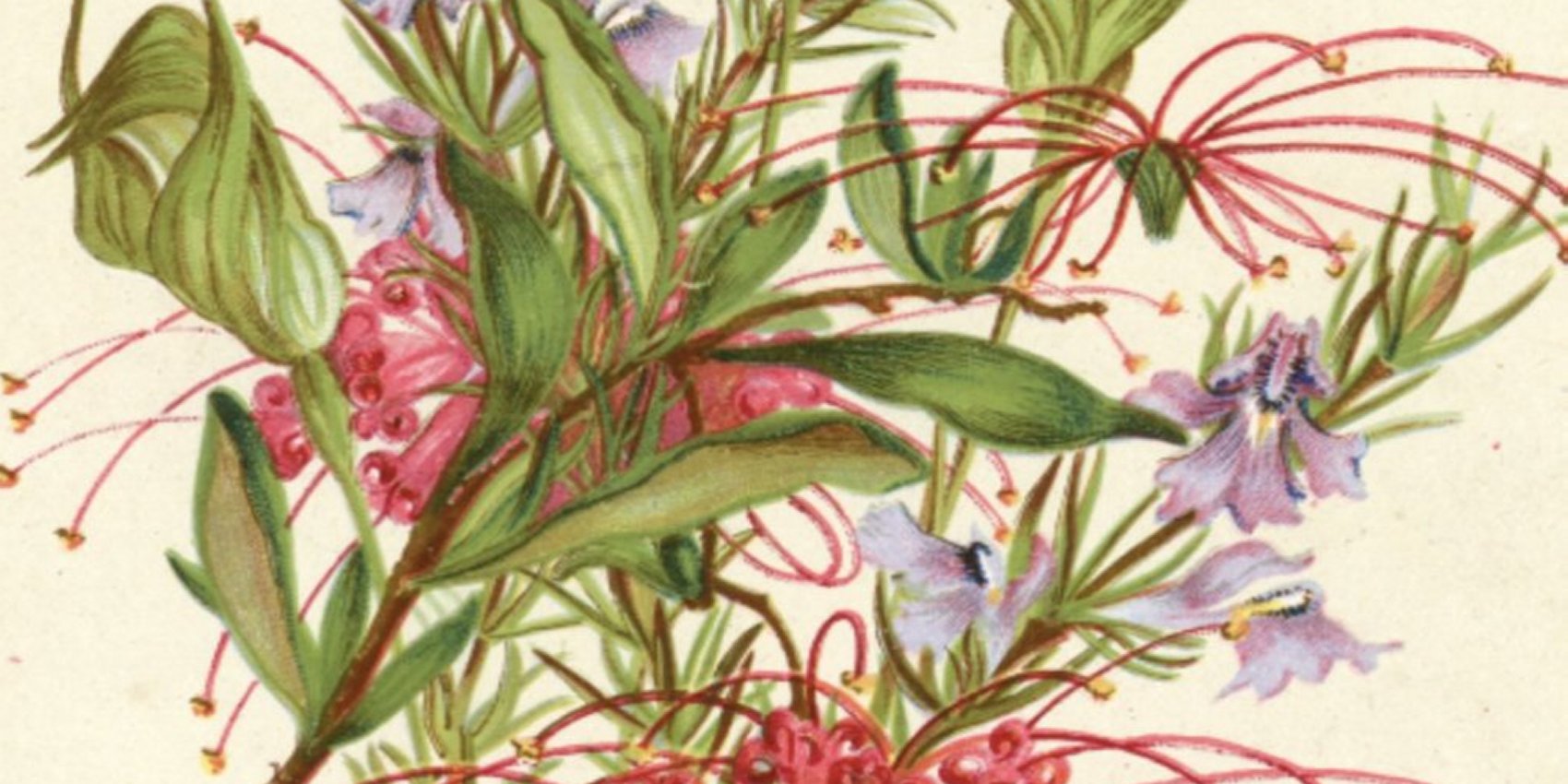
Ash Island was granted to Alexander Walker Scott, entrepreneur and keen naturalist in 1827. He grew oranges and established market gardens at Scotts Point. His daughters, Helena and Harriet, recorded and painted the diverse flora and fauna that still existed on the island at that time. Helena’s Botany of Ash Island (1862) guides current revegetation. Visiting naturalists, John and Elizabeth Gould and Ludwig Leichhardt, enthused about the beauty of nature and the great number of plants found there.
Farming era:
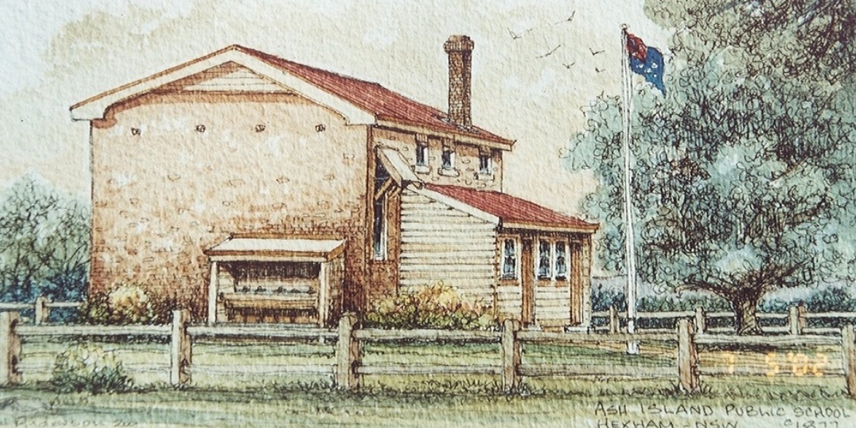
Ash Island was subdivided in the 1860s and cleared and drained for further agriculture; 17 dairies, 55 families and a school were here until mid-1900s. The island flooded regularly. After the 1955 (one-in-200-year) flood the island became State-owned and was leased for grazing. Crops of sorghum, maize and millet were grown as winter feed. Where City Farm now stands, the Milham family established a productive farm from 97 head of `well-bred Alderney’ milk cows imported from Germany. The farm, like the rest of Ash Island, suffered from periodic flooding of about 30cm every seven years and about one to two metres every 50 years. A major flood in 1893 wiped out Milham’s entire herd.
Industrial era:
Port and industrial activities started in the south-east of the estuary in the late 1800s. By the 1960s most of the estuary islands had been joined into one — named Kooragang Island in 1968 — which was intended for industry.

Environmental era:
Concerns about pollution in the 1970s led to the Coffey Inquiry which highlighted the importance of retaining natural habitat in the estuary. An area including the north-eastern third of Kooragang Island was set aside in 1983 as Kooragang Nature Reserve (now part of Hunter Wetlands National Park) and in 1984 was declared a Ramsar site (‘wetland of international importance’). In late 1992 a feasibility study was done for wetland compensation which led to the inception of the Kooragang Wetland Rehabilitation Project.
The one constant in an estuary is change.
Change is a feature of all living systems. Change can be fast or gradual, a result of natural processes or human activity.
Tidal changes:
Our most frequent form of change. Twice daily high tides bring nutrients, fish and other creatures seeking food and shelter. Twice daily low tides expose mudflats on which crabs and shorebirds feed. Tide height also varies seasonally, king tides occur in summer (daytime) and winter (at night).
Weather changes:
Freshwater/ brackish wetlands form in some parts of the estuary after rainfall or flooding, but these dry out during periods of drought. In time, the effects of climate change will cause sea levels to rise which will impact on the estuary and how it is managed.
Geological changes:
Erosion, land subsidence and sea level change alter the topography and distribution of vegetation such as mangroves and saltmarsh. Over time, as an area becomes more or less saline, a different community of plants (and animals) is favoured.
Man-made changes:
Draining, filling, clearing and dredging have affected the hydrology and therefore the character of wetlands in the estuary.